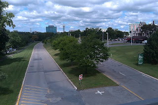
Niagara County's Robert Moses Parkway was constructed in the 1960s by the New York Power Authority. It follows the Niagara River from the North Grand Island Bridges to Lewiston, where it veers inland and continues to Lake Ontario. It was initially constructed to connect the area's numerous state parks. Though scenic at places, the road has always funneled more commuters to work than tourists to state parks, and is being gradually removed. It is named for the oft-maligned former chair of the Power Authority, and numerous other state authorities.
In the late 1980s, the section of the highway that ran through Niagara Reservation State Park (at 55 miles per hour) was removed, and its traffic rerouted through downtown Niagara Falls, NY. A visitors center, extensive gardens, and many trees were were put in its place. Remnants of the parkway are still visible and used for park vehicles, as seen in the above photo. The state is working to remove these remnants, between John Daly Boulevard and Prospect Street, in the near future, and replace them with a road similar to the Riverway planned by noted landscape architects Frederick Law Olmsted and Calvert Vaux, Niagara Reservation's original designers.
In addition, in 2003, half of the parkway between Downtown Niagara Falls and Devil's Hole State Park was closed to traffic and turned into a recreational trail. The Niagara Heritage Partnership is advocating for the full removal of the parkway between Downtown Niagara Falls and the Lewiston-Queenston Bridge. The Niagara Gazette recently announced that funding has been lined up for a scoping process that includes the Partnership's removal option.


